Nice little shelf there, hope the fish bit for yaSnapped this on my way home from fishing with my nephew. Grove City, Ohio.
Sent from my SM-G996U using Tapatalk
You are using an out of date browser. It may not display this or other websites correctly.
You should upgrade or use an alternative browser.
You should upgrade or use an alternative browser.
The Random Weather Thread
- Thread starter 03cobra#694
- Start date

Yep. Nephew hit 3 largemouth with a red and black worm. They hit it almost every time he threw it out. I hit one with the ole go to, haha. Whopper plopper always gets me atleast one bass. Blue gill at will and no dice on any catfish bites, but we did fine for the 2 hours we were out there. Got cut short for some reason....haha.Nice little shelf there, hope the fish bit for ya
Man, did we ever get hammered with rain yesterday. Got about 6 inches in a hour. Flooded the street from swale to swale. It was raining so hard picture didn't turn out.
yep I was watching that, as we had the same thing a few times earlier in the week in the late afternoons. Seems to be crossing the state west to east so far this year. Looks like that pattern may have broken up.Man, did we ever get hammered with rain yesterday. Got about 6 inches in a hour. Flooded the street from swale to swale. It was raining so hard picture didn't turn out.
No pics, but man did we get smoked with a mighty storm last night around 16:45. Lasted about an hour maybe. Friggin' monsoon! Gusty as hell, small hail, lots of branches down... Lightning struck so close by that I saw sparks bouncing off my first floor gutter. Power flickered off and on. Dish receiver started hissing and frying. The garage door opener for the 2-car side decided to open randomly and proceeded to keep trying to open further even after it was maxed. Wall button wouldn't do anything so had to unplug it to get it to stop. One-car side opened up fine after the storm, but then wouldn't close. Noticed the indicator lights on the photo eyes weren't lit, but the openers themselves have power. Garage lights inside and outside don't work. Tripped the GFCI for the garage fridge even though it's on a separate breaker from the other stuff. No breakers were tripped. Wild times. You guys down south are probably used to this shit. lol
Wow, stunning! I don't think I've ever seen one that wide. I did, though, see a double rainbow a few years ago in town.Caught this cool rainbow yesterday. It was strange because it was so short and wide and I could see every individual color.
View attachment 1751851
101⁰F
A pop up storm. >75mph measured winds,
Place down the street lost it's roof.
78 after the storm. Drive home west, it's dry and 99 and humid still.
This storm had no warnings lol
That palet was on the east side of the building, this door is facing west.


Sent from my S22 Ultra using Tapatalk
A pop up storm. >75mph measured winds,
Place down the street lost it's roof.
78 after the storm. Drive home west, it's dry and 99 and humid still.
This storm had no warnings lol
That palet was on the east side of the building, this door is facing west.


Sent from my S22 Ultra using Tapatalk
Summertime single celled storms that the bottom falls out of are some of the toughest to warn on. You've almost gotta warn on them before they've reached severe criteria because by the time radar data shows they are severe A-the data is already behind what the storm is doing in real time, B-they've already peaked and are in the end of their life cycle
Oh boy, microbursts.
My family was flying back from Mexico and was coming in for a landing and they went into one. Hit some nasty turbulance and the engines fired up to full tilt as they tried to climb back out of it. My sister in law said it was just a choir of people throwing up all at once.
Of course they don't supply barf bags on economy flights anymore.
I also had another friend who was flying in a Cirrus and hit a down draft or something, they were about 3500' off the ground, flew into it, and lost like 1500' in elevation in 30 seconds.
Pop-up storms are very hard to pin down if you don't have a time machine. Usually we'll get the "significant weather advisories" to cover these storms, but this one was "explosive" in terms of growth.Summertime single celled storms that the bottom falls out of are some of the toughest to warn on. You've almost gotta warn on them before they've reached severe criteria because by the time radar data shows they are severe A-the data is already behind what the storm is doing in real time, B-they've already peaked and are in the end of their life cycle
What is interesting is there was a ww for another cell in the SW corner of the county.
Oddly this wind was not the death rattle of either storm, it was just a narrow/focused strait line wind going strait north from the storm above while in a phase of explosive growth, with very little shear as wind aloft were weak, even surface level winds were calm (and thankfully only a few pieces of pea sized hail as it lacked the time to keep the pieces cycling/growing aloft.) On radar you could see the outflow boundaries shooting out 360* around the cells like rocks on a pond, more like what you'd see in Florida or somewhere tropical. This cell started drifting east after about 20-30 mins. Watch the NE side of Wichita, near Minneha 5:28-31 were when the strongest winds hit based on my cameras.

US-Radar HD 'Base reflectivity' from 06/21/2022, 05:04pm - Sedgwick
High resolution images of US radar locations with archive back to 1991: Base reflectivity, base velocity, storm tracking, ...
/cloudfront-us-east-1.images.arcpublishing.com/gray/5YP54PNO6NHSBLHDOPAV5YAS6U.jpg)
Yes... Especially flying when taking off or landing.
Last edited:
Pop-up storms are very hard to pin down if you don't have a time machine. Usually we'll get the "significant weather advisories" to cover these storms, but this one was "explosive" in terms of growth.
What is interesting is there was a ww for another cell in the SW corner of the county.
Oddly this wind was not the death rattle of either storm, it was just a narrow/focused strait line wind going strait north from the storm above while in a phase of explosive growth, with very little shear as wind aloft were weak, even surface level winds were calm (and thankfully only a few pieces of pea sized hail as it lacked the time to keep the pieces cycling/growing aloft.) On radar you could see the outflow boundaries shooting out 360* around the cells like rocks on a pond, more like what you'd see in Florida or somewhere tropical. This cell started drifting east after about 20-30 mins. Watch the NE side of Wichita, near Minneha 5:28-31 were when the strongest winds hit based on my cameras.
US-Radar HD 'Base reflectivity' from 06/21/2022, 05:04pm - Sedgwick
High resolution images of US radar locations with archive back to 1991: Base reflectivity, base velocity, storm tracking, ...weather.us
Yes... Especially flying when taking off or landing.
YES Sir.......Ground Proximity means everything when FLYING especially in foul Wx!!

We had a freak storm happen today in SoCal. 2 days ago the truck said it was 105° outside and today its in the 70’s. News is reporting someone was struck my lightning in this storm too.
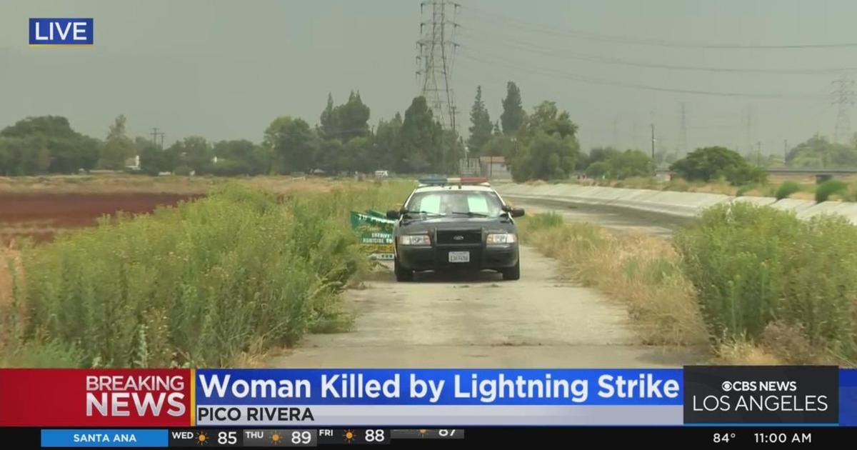
 www.cbsnews.com

Sent from my iPhone using Tapatalk Pro

Woman, two dogs struck and killed by lightning in Pico Rivera
The victim, identified as Antonia Mendoza of Pico Rivera, and her dogs were found on a walking trail near the San Gabriel Riverbed at around 9 a.m.

Sent from my iPhone using Tapatalk Pro

Holy chit! How'd you capture that 2nd image? Most pros spend years trying to get that shot.
I cheated and was recording the storm. It was a screenshot from the video. What’s crazy is how it affected the bottom of the image like that.
Sent from my iPhone using Tapatalk Pro
Normal afternoon storms here. They get damn nasty.
Just been dry and hot in south tx. It has been around 100 for the last several weeks and doesn't look like there is going to be much of a break any time soon.
Sent from my SM-G781U using the svtperformance.com mobile app
Sent from my SM-G781U using the svtperformance.com mobile app
Users who are viewing this thread
Total: 4 (members: 0, guests: 4)

